
Digital Tools for Finding Camp and Overland Travel
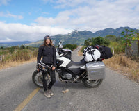
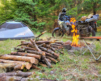
After motorcycling through Mexico the past 1.5 years, there are a handful of digital tools I use heavily to find amazing campsites and meet my traveling needs. If you’re planning an overlanding trip, you may want to check these out too!
iOverlander
Probably the number one digital tool for overlanders and travelers is “iOverlander,” a map-based app with listings for camping, hotels, sites, restaurants, and even more specific needs like mechanics in countries around the world.
Since the information is user generated by travelers, you will find useful tips like road conditions to sites and access to water or electricity. While the majority of users are “VanLifers,” there are also many motorcyclists who include moto specific information like secure parking.
Even in very remote areas, you can find recommendations for safe places to boondock or locals who have offered their property for tent space. Campsites are categorized by type: campground, boondocking, and businesses that allow camping.
With the app being accessible offline, it’s got what you need to search and find great information, primarily campsite recommendations. You can even directly link out to other apps like Google Maps or Maps.me and add a bookmark for planning.

Maps.me
Speaking of offline, the next recommended digital tool is Maps.me, which is an offline maps app. If you are camping and going into nature, you are bound to find yourself without a signal. But have no fear, with Maps.me you will still be able to access a map, search places, and receive navigation.
It may not be the primary mapping tool you use, but you should have it as a backup because you never know when you’ll need it. Don’t forget to download the area before you leave wifi. The app downloads sections by state so keep that in mind if you happen to be on a ride across states.
Often Maps.me will offer a different route as say, Google Maps for example, especially if you are on small or dirt roads. Having Maps.me as a secondary maps app will allow you to research your options deeper.
Which brings me to the next recommendation: Google Maps.
Google Maps
You might roll your eyes at the obvious nature of this recommendation but I cannot tell you how much use this app gets and for how many purposes. Therefore, I would be remiss to leave it out!
Google Maps has so much information that it can not only be used as your primary navigating tool but for research, discovery, and planning.
Here are the primary ways the tool can be helpful:
Primary Navigation:
Personally, I’ve never felt the necessity to invest in a separate device for navigation. As long as you have a charger from your bike, Google Maps has been more than sufficient for all my travels. Plus, you have loads of information all in one place, which is really convenient.
When planning routes I recommend using both Google Maps and Maps.me, especially when small or dirt roads are involved. When they do not offer the same options, do additional research (i.e. vet roads (below)) to find out more.
In the case of dirt roads, I have found Maps.me to be a little more reliable. Google Maps can have a tendency to think walking paths are roads.
Don’t forget to download Google Maps’ offline maps as well before heading out. Instead of downloading by state, you’ll need to choose a section on the map to download.
Research, Discovery, & Planning:
To repeat, there is so much information on Google Maps. Photos, reviews, and 360 views for almost everything, including natural sites. Searching Google Maps is a great way to find awesome campsites because people will mention in the reviews whether camping is permitted.
Often I will search different natural sites like volcanos, waterfalls, and watering holes and check the reviews for any mention of camping.
Sidenote, in Mexico it is often permitted to camp at these natural sites with a nominal fee (usually $50 - $150 pesos ($2.5 - $7.5 dollars)).
Alternatively, it is effective to search for “cabañas” who commonly allow camping onsite.
Lastly, use “bookmarks” in Google Maps to mark sites and nearby potential camping options to easily plan out your route.
Vetting Roads:
Route planning is another use case for Google Maps because you can dig deeper into the conditions of the road by using “street view.”
Most people are familiar with Google Maps’ 360 street view feature which allows you to drop a pin and click into a 3D view of a road and the surrounding area. You can even “drive” or move along the road to check conditions.
You may want to check if the route is dirt or paved or perhaps whether it’s scenic or full of telephone lines.
Switching to Satélite or Terrain map view will give you the big picture sense, perhaps you may be headed into mountains or altitude that you’d want to prepare for.
Being constantly on the move, it is common to pass through several climates, even in a single day, without realizing.
Mexico in particular is extremely diverse so you may suddenly find yourself in the mountains in the skip of a beat. Simply through the features on Google Maps you can get a quick heads up.

Sharing Location:
Lastly, the “share your location” feature on Google Maps is helpful, particularly for family and friends who may worry about you on the road. With this feature, they have an (almost) real time update of your whereabouts.
Each time you open Google Maps it updates your location. Essentially they will see “your dot” moving along the map.
It can give peace of mind that someone always knows your location and keeps the worry-bees off your back :)
Caveats
Beware of the “google sent me here” conundrum where Google Maps marks a road which is more like a walking path. Unfortunately, it’s not an uncommon occurrence, for example, in small windy colonial towns or off-road, however, if you are aware that it can happen, you will be able to sniff it out.
In addition, be aware that information can be outdated on Google Maps. Usually, it’s minor, like store hours or closed businesses, but it can save you a headache if you reserve the possibility that the information is incorrect.
Google Earth
Another great way to gather information about roads and routes is through Google Earth, which provides 3D images of the landscape and areas from several perspectives.
Use this in addition to Google Maps’s street view to make decisions about your route.
In the US, WhatsApp is not so commonly used but in practically the rest of the world, it is the primary tool for communication. Not only can it be used to call/text family back home without cell service (wifi only), it’s also used to communicate with most local people and businesses.
Say you want to book a tour, find a mechanic, or schedule a massage on your travels, most businesses conduct all inquiries, communications, scheduling, and booking via WhatsApp.
It’s also common for locals to offer their number as a kind gesture in case you need anything. Take them up on it, people are so kind around the world, and personally it has saved me a few times.
In regards to phone service while abroad, usually it’s best to buy a local SIM card (very cheap) and insert it into your unlocked phone. Google Fi service also permits use around the world with unlimited data options as long as it’s not for an extended period of time.
Google Voice
WhatsApp will cover most of your communication needs while on the road abroad, however, there may be some instances when it does not suffice and this is where Google Voice comes into play.
WhatsApp or Facetime etc… will allow you to make calls to friends and family abroad but if you need to call a landline in the US you’ll need Google Voice.
Common scenarios would be if your credit card or bank puts a hold on your account for “suspicious activity” using it abroad or you need to order a new ATM card. Google Voice enables you to call landlines and 1800 numbers over Wifi.
Skype is another good option which offers inexpensive packages, about $3.50 USD per month, for unlimited landline calls.
PolarSteps
Lastly, this one's for fun. PolarSteps is an app that helps capture and document your adventure as it tracks your journey from one destination to the next. You can share your profile with others to follow and add details to your trip like photos from each location etc… At its most basic level, have the app run in the background and you’ll have an automatic neat little map of your travels.
Well, that covers the basics! If you’re looking specifically for off-road tracks, there are other great apps but that’s for another article. Simply with these few apps, you can discover awesome camping spots in remote areas in Mexico and beyond, feel comfortable about the route, have the connection you need, and leave the rest up to adventure!